


LE ROUET - Le Vallon du Leyron- La Grande Baisse

Michel DUBOIS
User
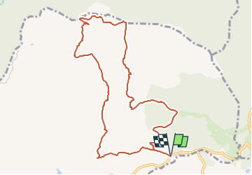

Length
11.2 km

Max alt
471 m

Uphill gradient
468 m
Km-Effort
17.5 km

Min alt
92 m

Downhill gradient
468 m
Boucle
Yes
Creation date :
2025-04-28 13:25:46.423
Updated on :
2025-04-28 13:29:10.227
3h58
Difficulty : Medium

FREE GPS app for hiking
 SityTrail
IGN / Geographical institutes
SityTrail Plus
The world is yours!
About
Trail Walking of 11.2 km to be discovered at Provence-Alpes-Côte d'Azur, Var, Le Muy. This trail is proposed by Michel DUBOIS.
Description
Rando BOULIN rallongée de 3 kms
Positioning
Country:
France
Region :
Provence-Alpes-Côte d'Azur
Department/Province :
Var
Municipality :
Le Muy
Location:
Unknown
Start:(Dec)
Start:(UTM)
308479 ; 4820822 (32T) N.
Comments